
File:Angola Map.jpg
Size of this preview: 482 × 599 pixels. Other resolutions: 193 × 240 pixels | 386 × 480 pixels | 618 × 768 pixels | 1,030 × 1,280 pixels.
Original file (1,030 × 1,280 pixels, file size: 283 KB, MIME type: image/jpeg)
| Description |
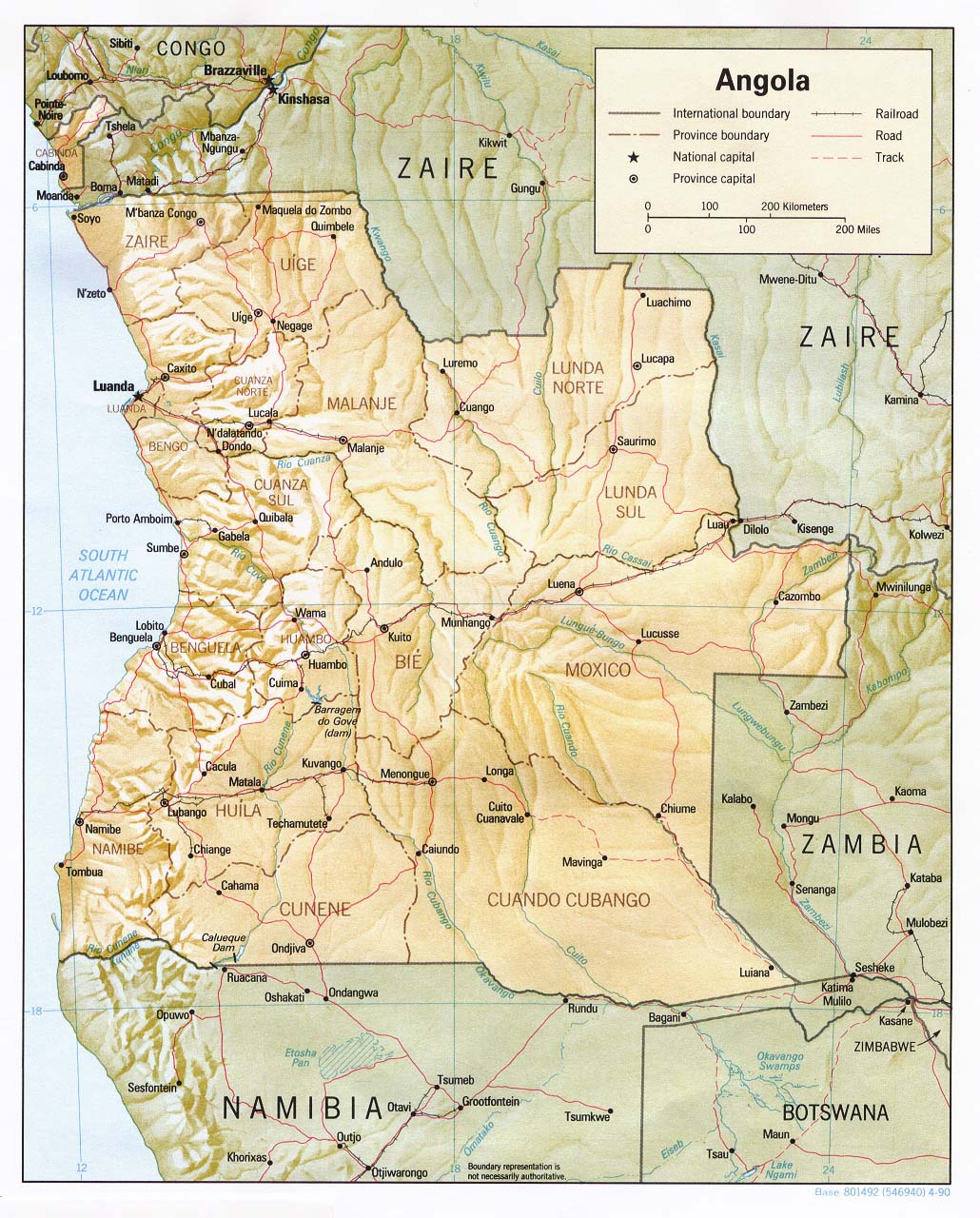
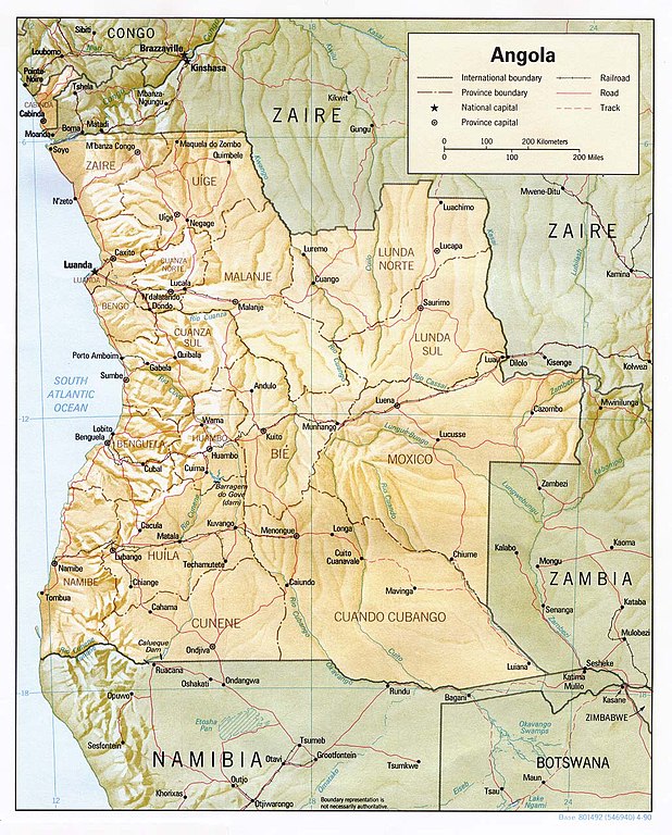
English: Shaded relief map of Angola. |
|||
| Date | ||||
| Source | [1] from the Perry-Castañeda Library Map Collection. | |||
| Author | CIA | |||
| Permission (Reusing this file) |
|

![[1]](http://www.lib.utexas.edu/maps/africa/angola_rel90.jpg)
File history
Click on a date/time to view the file as it appeared at that time.
| Date/Time | Thumbnail | Dimensions | User | Comment | |
|---|---|---|---|---|---|
| current | 11:32, 21 February 2006 | | 1,030 × 1,280 (283 KB) | Lupo | Shaded relief map of Angola. Source: [http://www.lib.utexas.edu/maps/africa/angola_rel90.jpg] from the [http://www.lib.utexas.edu/maps/angola.html Perry-Castañeda Library Map Collection]. {{PD-USGov-CIA}} Category:Maps of Angola |
File usage
There are no pages that use this file.